The mining sector is the largest single contributor to the Australian economy, accounting for more than 10% of GDP.
Mining also plays an important role across Queensland, with the state being a major producer of coal, lead, zinc, alumina and copper. However, in response to global efforts achieve net zero emissions and respond to climate change, the demand for resources is changing. The consumption of thermal coal used for electricity generation is expected to decrease, while the extraction of critical minerals is projected to increase.
Critical minerals are those used in renewable energy products, electric vehicles, low-emission power sources and various other modern technologies that will support the economic transition. For example, global lithium production needs to increase by 40 times in the next 15 years, whilst demand for graphite, cobalt and nickel will grow by 20–25 times.
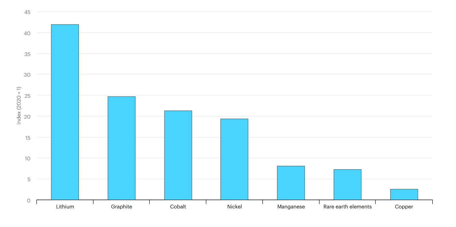
Growth in demand for selected critical minerals by 2040 relative to 2020 under a sustainable development scenario. Source: IEA 2021
Queensland has a range of critical mineral resources, including copper, zinc, alumina and vanadium. This means there will be a shift in the location and type of mines across Queensland, as some mines close and new mines are opened.
Point and click on the colour boxes to view the locations of current mines.
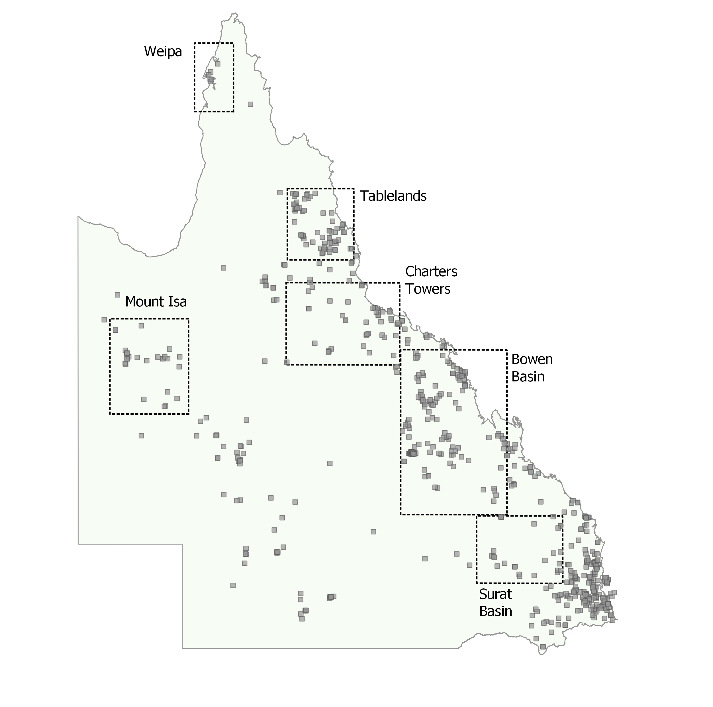
Operating Queensland mines: Map of currently operational mines in Queensland and the main mining regions. The mines extract various metals, coal, building materials, agricultural products, and gemstones. This can be further explored through the Queensland Department of Natural Resources and Mines, Manufacturing and Regional and Rural Development website.
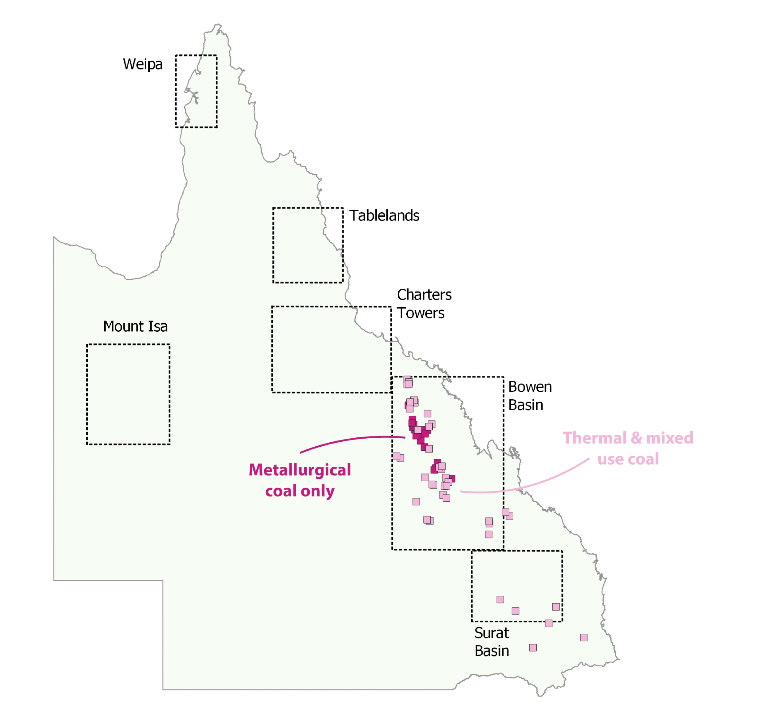
Queensland coal mines: Queensland coal is not only used for electricity generation (thermal coal) but also for steel-making (metallurgical coal).
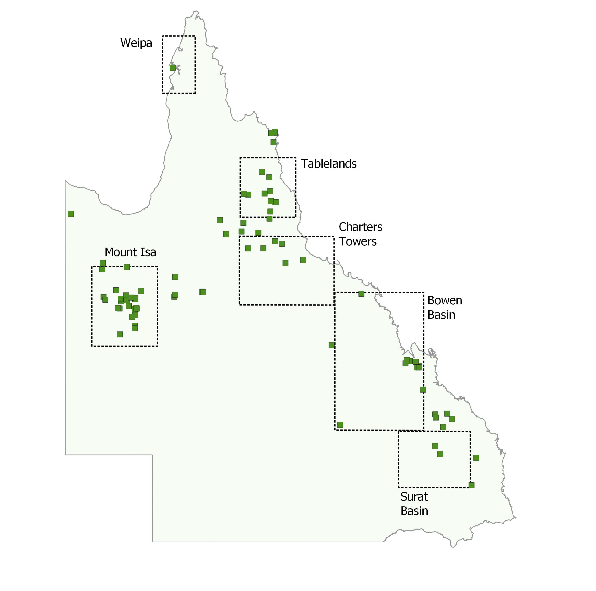
Queensland critical mineral mines and deposits: Location of mines already extracting critical minerals, and locations of mineral deposits containing critical minerals that may be developed in the future. This data was obtained from Geoscience Australia and details on commodity types can be viewed on their website.
Operating Australian mines: Map of operational mines across Australia for 2023, showing the larger metal, mineral and coal mines. More information on extracted commodities can be accessed through the Geoscience Australia website.
Australian coal mines: The major coal mining regions of Australia are the Bowen Basin in Queensland and the Sydney-Gunnedah Basin of New South Wales. Otherwise, a small number of coal mines are also found in Victoria, Tasmania, and Western Australia.
Australian critical mineral mines and deposits: Location of mines already extracting critical minerals, and locations of mineral deposits containing critical minerals that may be developed in the future. This data was obtained from Geoscience Australia and details on commodity types can be viewed on their website.
Climate sensitive mine life cycle
Mines are not permanent operations, but rather have a life cycle spanning from multiple decades to over a century. This life cycle is divided into four main sequential stages:
- The exploration stage when the deposit is discovered and defined,
- The development and construction stage where the mine site and infrastructure are built,
- The mining phase where the bulk of the ore is extracted, and
- The closure stage when the land is rehabilitated for other uses after the ore has been extracted.
Various activities occur at each stage of the mine life cycle, many of which are directly influenced by, or vulnerable to, the local climate. Typical climate hazards that most Australian mines are exposed to include floods, storms and extreme rainfall, heatwaves, and bushfires.
Point and click on the image to see the detailed explanation of the various activities and how they are influenced by climate.
Machinery & Infrastructure
Background:
Processing plants, offices, water pumps, excavation and haulage trucks are examples of typical machinery and infrastructure found at most mines. Remote mines also build miners camps for worker accommodation and may have to construct railway lines to transport their commodity.
How is machinery & infrastructure impacted by climate and climate hazards?
Mine sites are exposed to a range of climate hazards affecting the infrastructure. Extreme heat can result in equipment failures or buckling of railway tracks. Strong wind gusts or cyclones can tear apart buildings. Bushfires and floods also cause damage.
How are impacts managed and /or mitigated?
A lot of machinery is specifically built for harsh mining environments. Infrastructure is also designed to be able to handle certain climates. Some activities may occasionally have to be paused to limit damage from hazards such as cyclones.
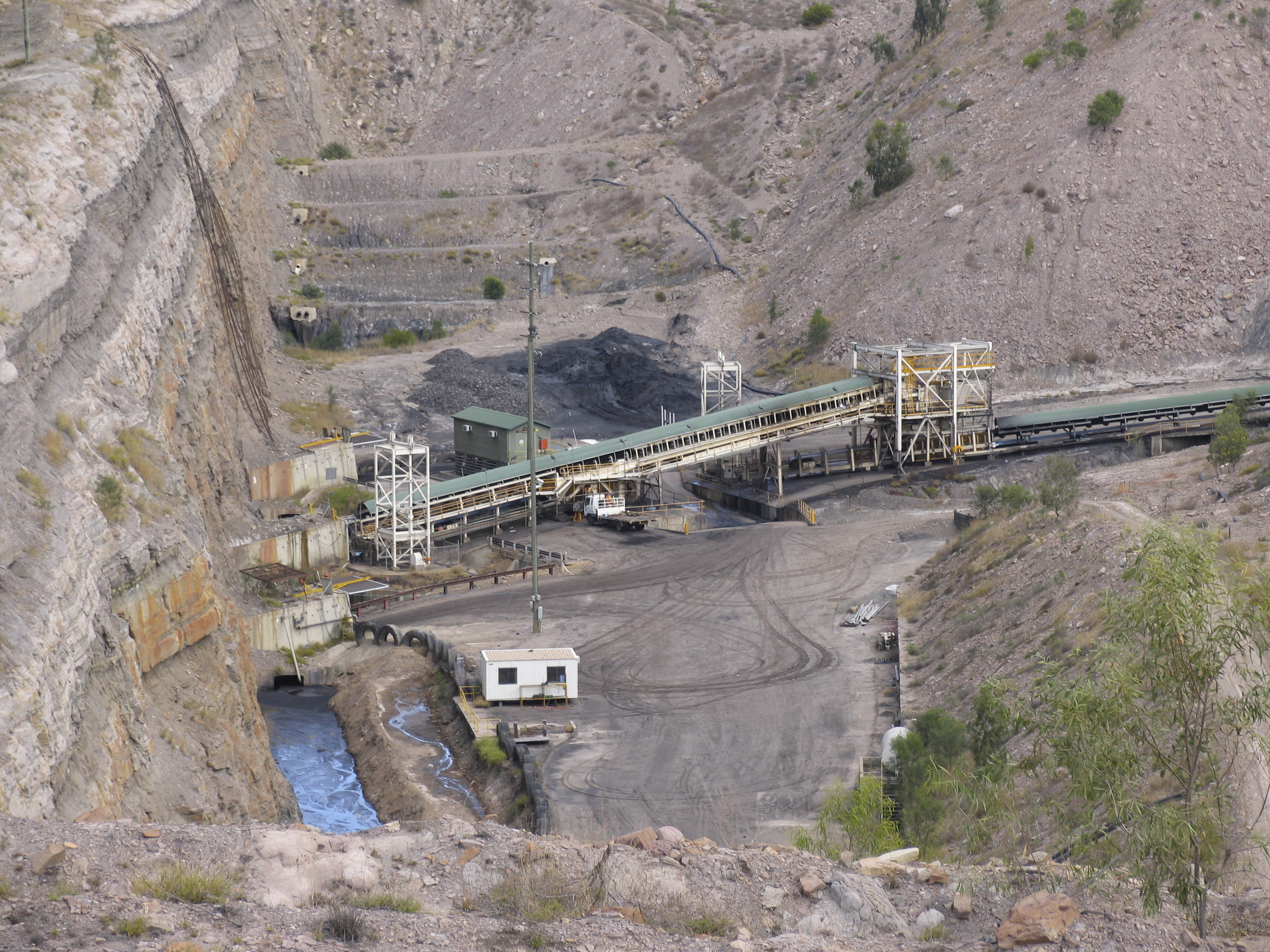
Conveyor belts moving coal from underground to the processing plant.
Worker Health & Safety
Background:
Mine sites employ a large number of people especially during the mine site construction and operation stages. The majority of workers are located on remote sites away from towns and exposed to the natural elements on a daily basis.
How is worker health and safety impacted by climate and climate hazards?
Workers may have to contend with a range of climate hazards affecting their work environment, including extreme heat aggravated by open and exposed outdoor environments. There are also risks of bushfires, and floods that may cut off access to or from a site.
How are impacts managed and /or mitigated?
All workers have to wear appropriate clothing to protect them from the harsh conditions they are exposed to. Risk assessments and short daily pre-work meetings are common ways of identifying and managing risks from climate hazards. It may be necessary to stop some kinds of work in extreme conditions.
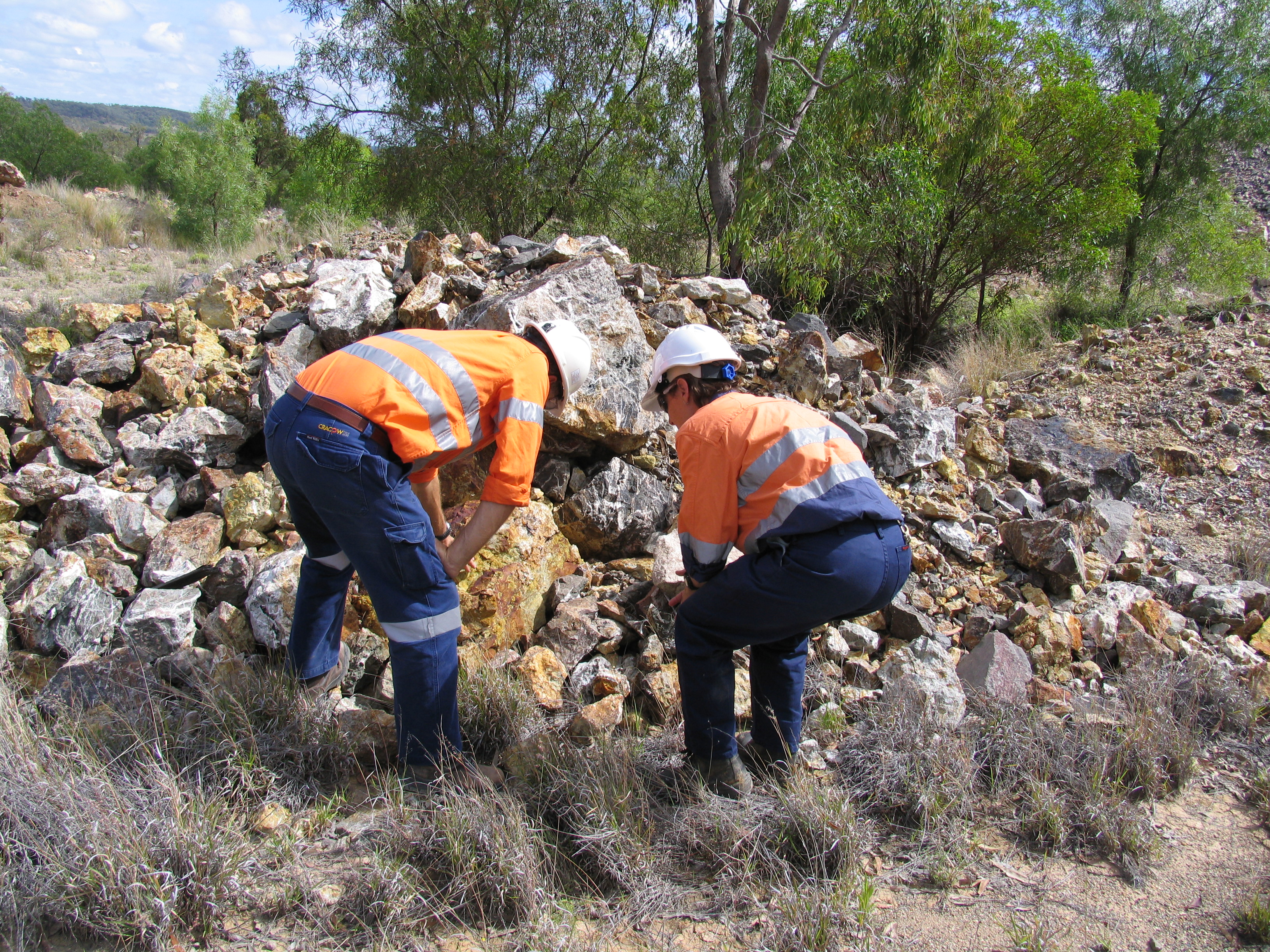
Workers investigating composition of waste rock material.
Water Quality
Background:
Mining produces waste rocks and tailings. These mine wastes can contain salts and metals that are potentially harmful to people and the environment. Water passing through mine wastes may leach and become loaded with these substances, contaminating soil, surface water and groundwater.
How is water quality impacted by climate and climate hazards? .
The amount of salts and metals that can be leached from mine wastes into the environment depends on weathering processes that are controlled by various factors, including air temperature, evaporation and infiltration of rainfall into the waste. Long periods of dry weather allow salts and metals to build-up, while heavy rainfall can allow them to be rapidly released into the environment in large quantities.
How are impacts managed and /or mitigated?
Modern mine waste dumps and tailings storage facilities are designed to minimise weathering and leaching of salts and metals. This can be achieved by separating the wastes from water flows, or with various technologies used to stabilise the waste. Another option is treating and/or safely disposing of contaminated water.
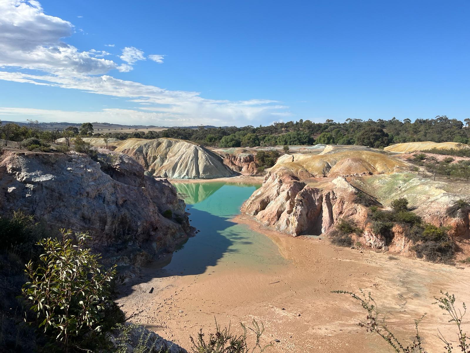
Build-up of turquoise, copper-rich water at the historical copper mine in Kapunda, South Australia.
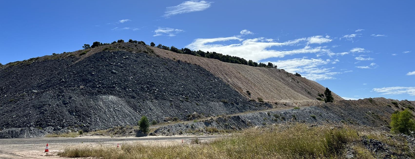
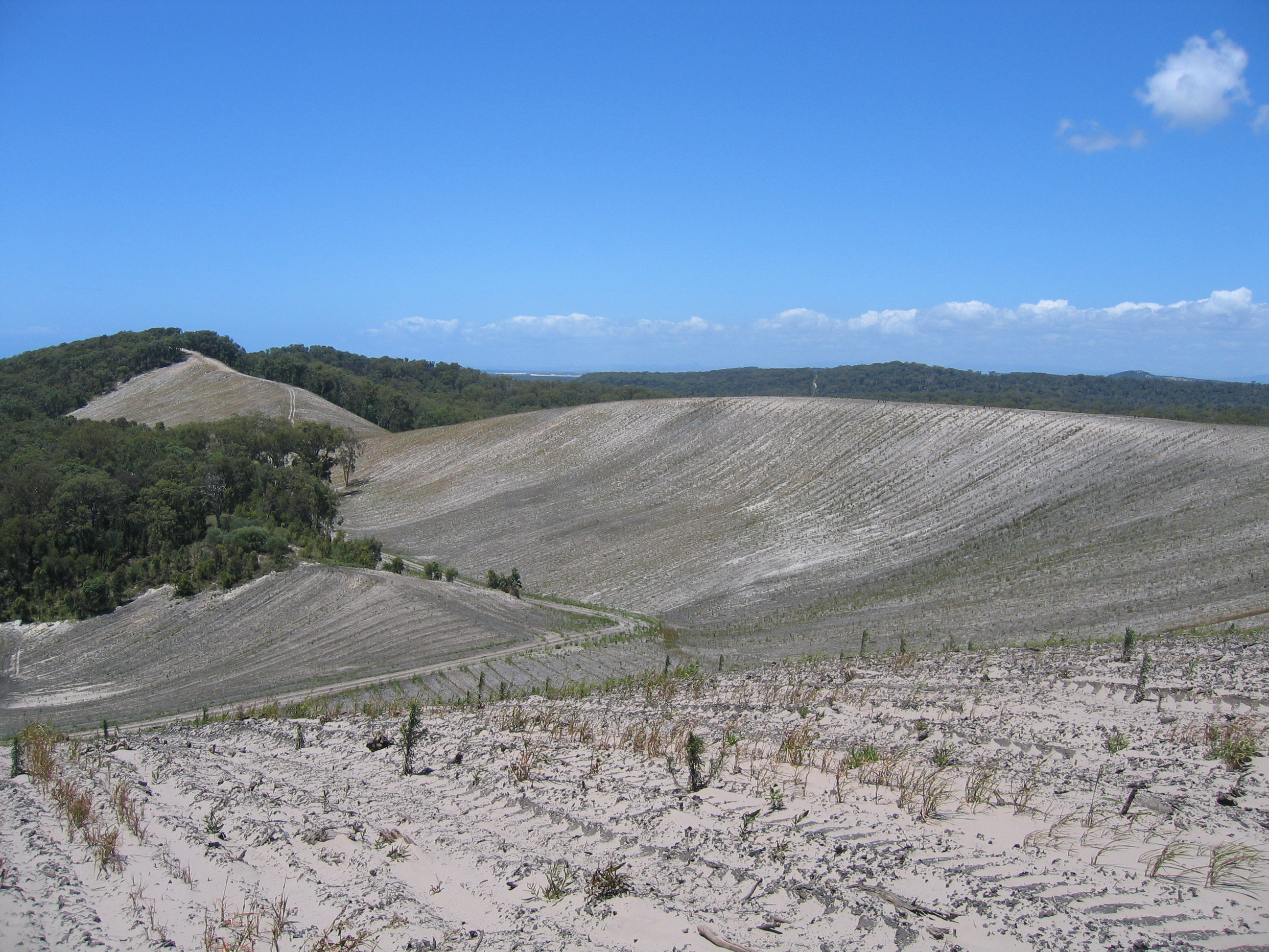
Landform Stability
Background:
Mining usually produces large quantities of waste rock. The waste rock dumps, also called constructed landforms, are shaped and covered with soil to be safe, stable, non-polluting, and ideally to support an economic or ecological land use once rehabilitated.
How is landform stability impacted by climate and climate hazards?
In comparison to natural landscapes, constructed landforms are especially vulnerable to erosion because they have not had the same time to stabilise. The forces of wind, rainfall and flowing water remove the topsoil covering the waste rock. This can create air and water pollution and destabilise the landform. Erosion rates are impacted both directly and indirectly by climate. Direct climate impacts are those related to the erosive power of rainfall. Indirect impacts include climate influences on plants and soil properties, which in turn influence erosion rates.
How are impacts managed and /or mitigated?
Landforms are designed to be stable, and that erosion rates are kept within acceptable limits. Erosion rates of constructed landforms are calculated by engineers and can be altered by adjusting factors like slope, shape, vegetation and soil amendments.
Site Water Balance
Background:
Mines need water for their operations, for example to help extract metals from rock or to spray roads for dust reduction. To ensure a continual supply of water in dry periods, a lot of water needs to be stored on the mine site. However, heavy rainfall can lead to too much water, which can flood the mining areas and access roads, and can require water to be released to neighbouring rivers.
How is the site water balance impacted by climate and climate hazards?
The site water balance measures the amount of water stored on the site. It depends on the local climate and is most strongly influenced by the amount of rain and evaporation. Climate also influences local streams and groundwater, which may add water to the site water balance.
How are impacts managed and /or mitigated?
Water is stored on sites using constructed basins or old mine voids. Water is prevented from entering the mine site with stream diversions or pumping of groundwater. Excess water of reasonable quality may be released into rivers surrounding the mine site.
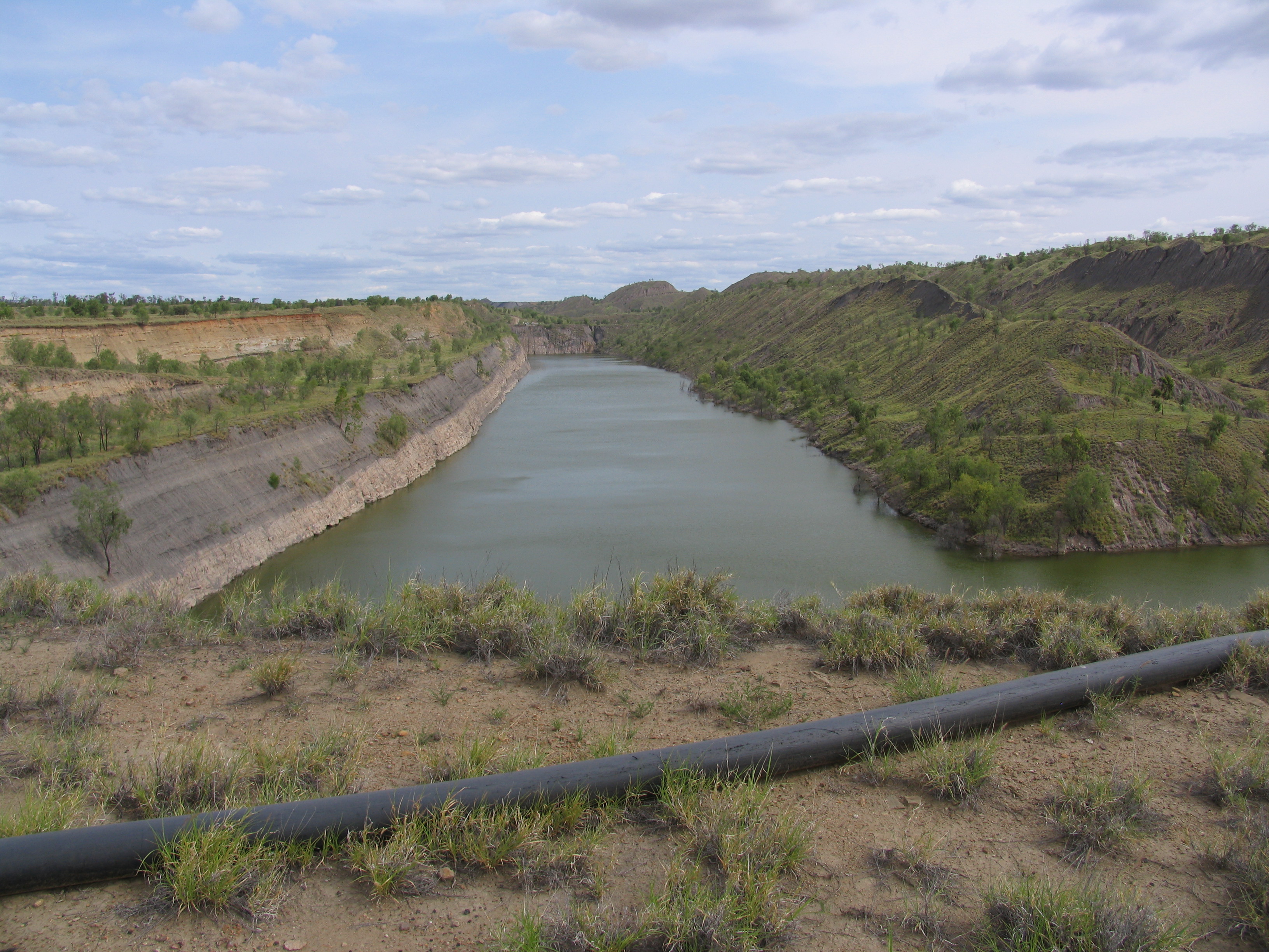
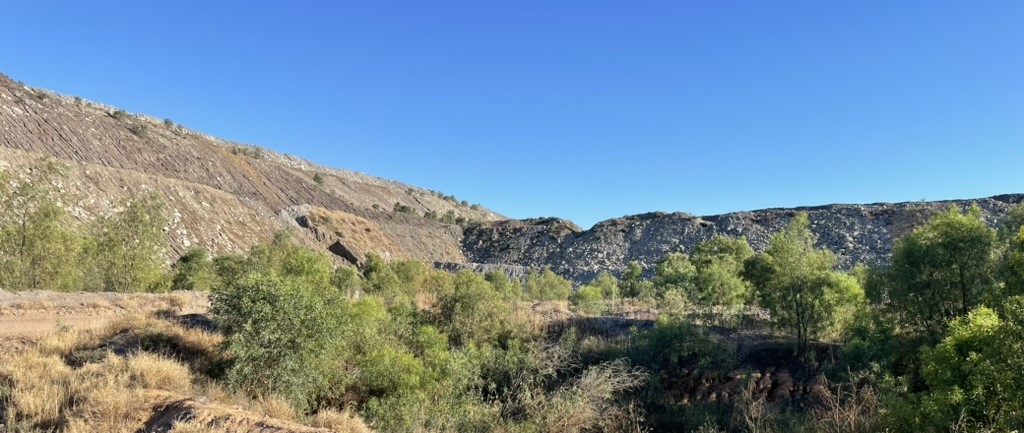
Bowen Basin coal mine void converted into a site water storage facility
Flood Risk
Background:
Extreme rainfall can result in flooding of mine site infrastructure such as roads, tailings storage facilities and mine voids, as occurred in Queensland during the devastating 2011 floods . Large floods can damage infrastructure, disrupt operations, or even cause deaths and environmental disasters.
How is flood risk impacted by climate and climate hazards?
The size of a flood is related to the intensity and duration of extreme rainfall events. Smaller rainfall events can also cause floods if the soil is already saturated and is unable to absorb more water. Flooding at mine sites near the coast can be worsened by other factors such as tides and storm surges.
How are impacts managed and /or mitigated?
Mining infrastructure such as roads and dams are all designed to Australian engineering standards. Engineering standards provide design rules to prevent overtopping of structures and catastrophic failures. Mine sites also control flood waters with “bunds” that serve a similar purpose to river bank levees in towns.
Flooding of regional access roads on the way to a mine site.
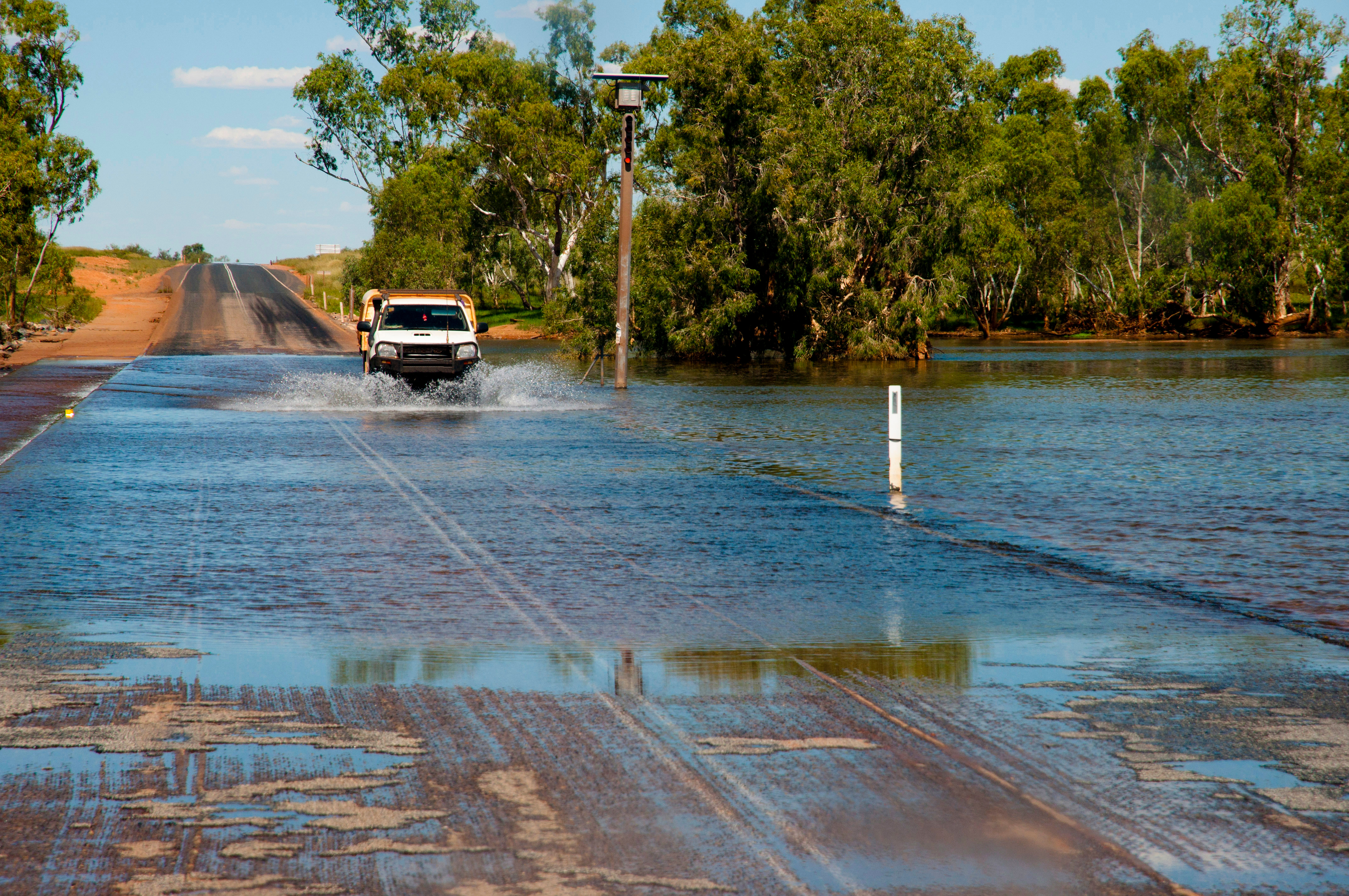
Flooding of regional access roads on the way to a mine site.
Source:
Adobe Stock ImagesSite Revegetation
Background:
Clearing of vegetation to make way for a mine site is common practice. Towards the end of the mine life cycle, mine-impacted land needs to be rehabilitated. Revegetation is one of the key rehabilitation activities that allows the mine site to be repurposed for another use, such as grazing or returning it to a native ecosystem.
How is site revegetation impacted by climate and climate hazards?
Site climate is one of the important factors influencing selection of plant species used in mine site revegetation. Depending on the species, different aspects of climate can be important. These include average rainfall and potential evapotranspiration, whether the region experiences frosts, and frequency and severity of droughts.
How are impacts managed and /or mitigated?
Mine sites are degraded landscapes that need our assistance to be converted into new, man-made ecosystems. Ideally, the new ecosystems are provided additional help and protection (from wildlife and natural elements) in the initial years after replanting to help them thrive under altered conditions. The chances of the site being successfully revegetated are improved by selecting native plants suited to the local climate and the nutrient-deficient soils. Some mines run revegetation trials to help guide this.
Native vegetation reestablishment on a constructed landform.
As can be seen in the interactive figure above, climate plays an important role on Australian mine sites, influencing the design of infrastructure, how the site is managed, and worker health and safety. Climate change means that climate conditions will change into the future. As such, climate change impacts need to be considered in the design, management and closure of mine sites.
Measuring climate change risks to mining regions
Measuring and predicting potential climate change impacts and risks is important for mine planning. Data on climate change is a valuable communication tool for informing the mining industry, regulators, communities and other stakeholders about potential changes that may occur in the future.
The diagrams below show how climate-based indices can be used to measure climate change risks to five mine site elements highlighted in the previous diagram. Note that two elements (“Worker health and safety” and “Machinery & infrastructure”) are not included here. A representative climate index is selected for each mine site element. A simple analysis is carried out that measures future changes to the climate indices, providing broadscale understanding of the main climate change risks affecting entire mining regions. More detailed methods are better-suited to looking at individual mine sites, because they also consider other important biological and physical factors on top of climate.
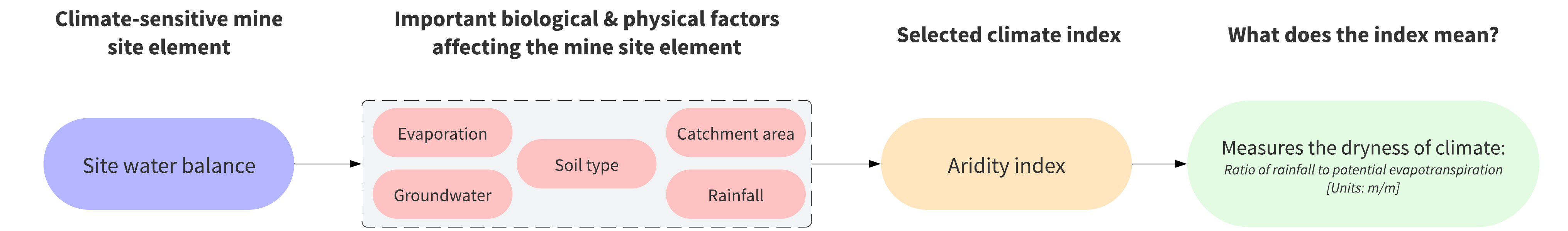


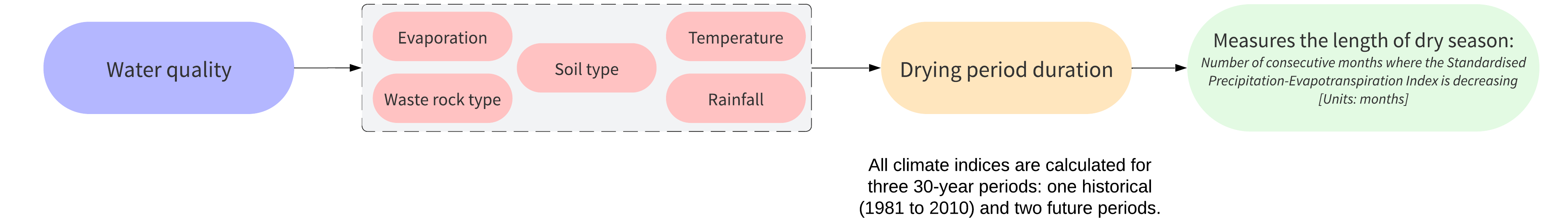
All climate indices were calculated using downscaled climate projections (precipitation and pan evaporation data) produced by Queensland Future Climate Science Program. They are calculated for two different greenhouse gas emission scenarios to understand the impacts of different but plausible pathways for future greenhouse gas concentrations under different social and economic conditions:
- An intermediate scenario (RCP4.5) where the amount of greenhouse gases released into the atmosphere decreases in the second half of the 21ˢᵗ century
- A high scenario (RCP8.5) meaning that greenhouse gas emissions are not managed and continue to grow
The data are freely available through the Terrestrial Ecosystem Research Network and more details on this method are provided in a recent scientific article.
What do climate models say about the type of future mine sites will have to contend with?
Mine sites in the future will have to contend with climate conditions that are different to the present day. Climate projections indicate the expected changes and impacts will be diverse – varying among mining regions of Queensland and also among the different mine site elements. The maps below show how the selected climate indices - representing each mine site element - are expected to change across Queensland by the end of the 21st century under a high emission scenario (RCP8.5).
Climate models show that Queensland’s climate will get drier across most of the state over the period 2070 to 2099. This means that many mines will have less water on site in future. The biggest changes are expected in the high rainfall regions near Cairns and northwards into Cape York.
Extreme droughts are also expected to occur more frequently. This means that plants used for revegetating mine sites in Weipa may experience increases in extreme drought by 1.4 months per year by 2100, while for Mount Isa this will be an extra 2.8 months.
In contrast, the outlooks for changes in drying period duration differ across Queensland but are not as drastic. The length of periods without rain will not change much across eastern Queensland this century. This means that climate change may not be a major water quality risk to mine sites in the Bowen Basin, Surat Basin, and Charters Towers.
Despite climate models projecting a drier future, extreme daily rainfall intensities will increase on average by 8.4 mm across Queensland by 2100. This means mine sites may be more flood-prone in future.
Similarly, rainfall-based erosion will also generally increase because of climate change, with the exception of the area between Townsville and the tip of Cape York, where there may be a reduction of up to 30% in erosion. Constructed landforms in these regions should be more resilient to climate change.
Select what information you want displayed in the map below. This includes climate index, emission scenario and future time period. Check the side-plot to understand how future changes differ amongst mining regions and between mine sites.
For more comprehensive information on a mining region, select the region of interest.
Climate resilient mine site planning and design
Industry standards, guidelines and guidance are the primary tools used by the mining sector to guide the design, management and closure of mine sites. These guidelines cover a wide-range of topics from water availability, to erosion and sediment control, and discharge of mine-impacted water. Specific examples include:
- Guidelines for developing Progressive rehabilitation and closure plans for mined land;
- Guidance on what needs to be considered and incorporated into an Environmental impact statement for mined land;
- The Australian Rainfall and Runoff guidelines used for estimating floods that are used by engineers in the design of flood-impacted infrastructure such as dams.
Other standards, guidelines and guidance commonly applied in the mining sector are focussed on corporate-level sustainability reporting. Subscribing to these standards is an industry commitment to responsible mining and provides a way for companies to publicly disclose environmental and social performance. For instance, the Global Industry Standard on Tailings Management (GISTM) was developed in response to the catastrophic dam collapse at Vale’s Corrego de Feijao mine in Brumadinho Brazil. It provides a framework that mines can implement to ensure the safe and responsible management of tailings facilities.
Climate change risks must be considered in many of these technical and sustainability standards and guidelines. However, limited advice is generally provided on how best to account for climate risks, rather giving companies the flexibility to choose how they tackle the challenge.
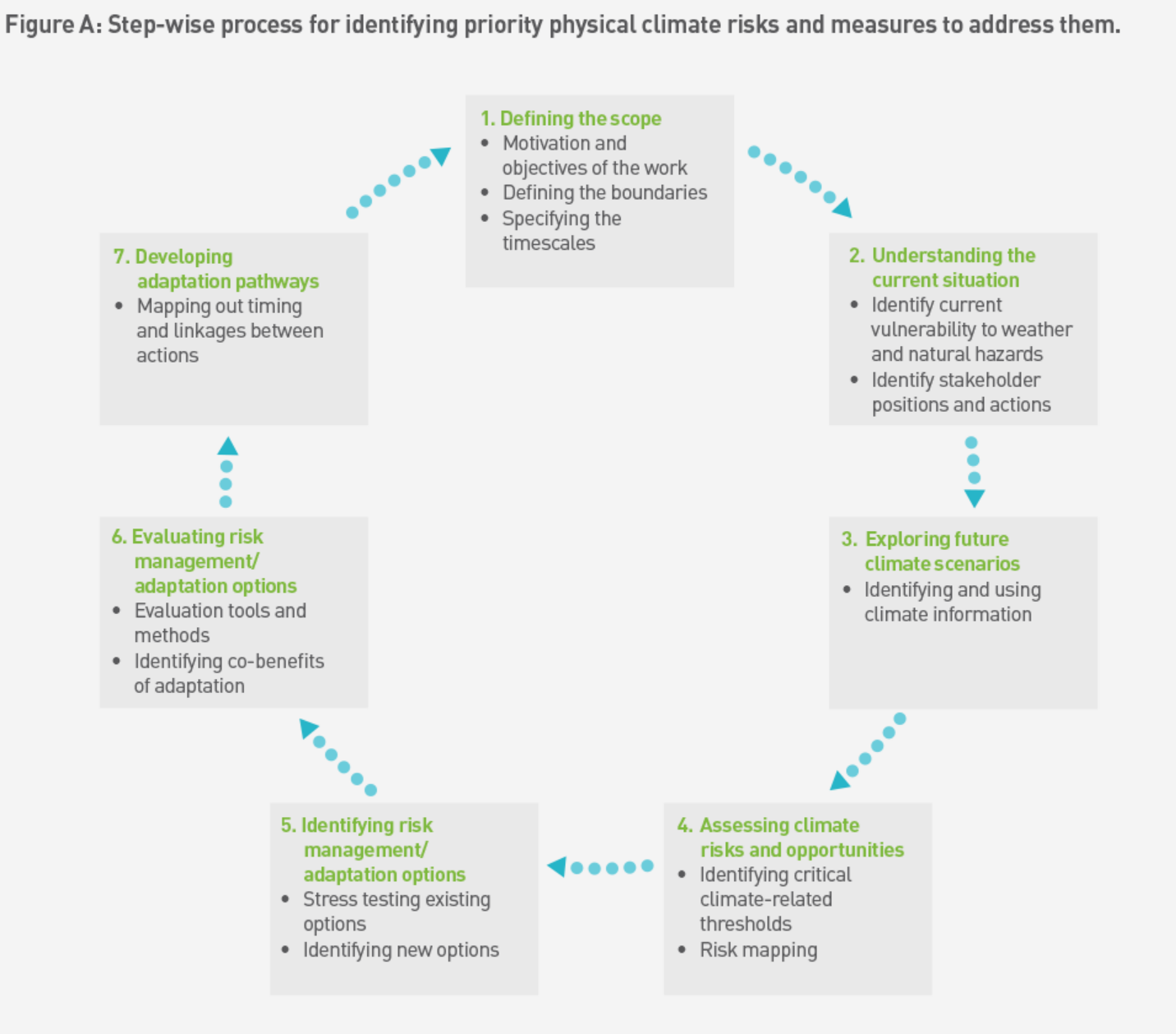
The International Council on Mining and Metals released a defining document in 2019 on Adapting to a Changing Climate: Building Resilience in the Mining and Metals Industry One of the main outputs is a step-wise process that companies can use to help integrate climate impacts into existing risk-based frameworks. The seven main steps are illustrated in the diagram below.
State-of-the art data products are being provided by the Queensland Future Climate Science Program. Future climate variables under a range of emission scenarios can be explored on the Future Climate dashboard , while summarised data can be downloaded through the Regional Explorer Dashboard and used in assessing mine site climate risks. Sector-specific climate change factsheets are also available, and can be used as an additional source of data to help understand certain climate risks. For instance, a recent report by the Queensland government summarises what climate change may mean for individual water plan areas which may in turn affect mine sites access to water.
Numerous mining companies now employ climate scientists to help understand and include climate change risks in different parts of the business planning. These efforts to improve climate resilience of mine sites are also being supported by the Minerals Council of Australia (MCA) – a national peak body - through various activities outlined in the Climate Action Plan In particular, activity 8.3 summarises how the MCA plan to: "Understand and share how mining operations are assessing and managing the physical impacts of climate change on site to build operational resilience".
Note that the information contained within this case study is intended for informative purposes only. For further information on Queensland Government climate policies and frameworks, please please visit the the Queensland Treasury Website .
